A Flood Watch has been issued for portions of South Central Texas through 7 AM Thursday morning. In general, 1 to 2 inches are rain are expected in locations in the Flood Watch with local amounts up to 5 inches possible. This may lead to isolated flash flooding.
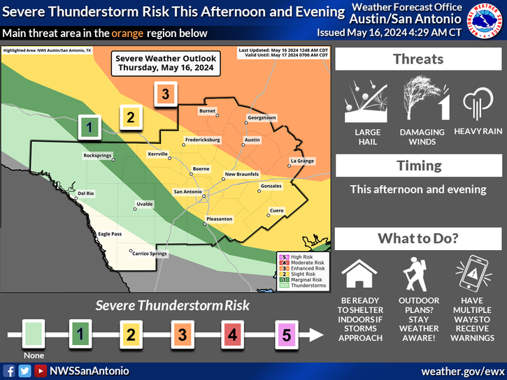
Isolated to scattered strong to severe storms are forecast for this afternoon through tonight. Large hail and damaging winds are the main threats. Can't ruled out a tornado or two. Locally heavy rain could lead to flooding.
A Flood Watch is in effect for the eastern half of the region with locally heavy rainfall expected overnight. Severe storms with damaging winds being the primary hazard along with some large hail and perhaps a tornado or two will be possible this evening.


 Austin/San Antonio Radar
 Weather Map
 Satellite Imagery
 Del Rio Radar
 Digital Forecast Map
 Tropical Outlook
 Drought Status
 Air Quality
 Fire Weather Forecasts
 Observed Rainfall
 Observed Temperatures
 Daily Climate Graphs
 Follow us on YouTube