Trails for everyone, forever

Home Go Hiking Hiking Guide Scott Pierson Trail

Scott Pierson Trail

Puget Sound and Islands > Seattle-Tacoma Area
47.2580, -122.5371 Map & Directions
Length
6.6 miles, one-way
Elevation Gain
383 feet
Highest Point
390 feet
Calculated Difficulty About Calculated Difficulty
Moderate
View west on the Scott Pierson Trail with the Olympics peeking out behind. Photo by Erik Morgenstern. Full-size image
  • Coast
  • Mountain views

Parking Pass/Entry Fee

None
Saved to My Backpack

A paved urban trail along the Highway 16 corridor named for a long time Tacoma planner and bicycle advocate. The jewel of this walk is access to the Tacoma Narrows and views from the bridge. Continue reading

Rating
2.00 out of 5

Hiking Scott Pierson Trail

The Scott Pierson Trail is a paved, multi-use trail that runs from 24th Street NW on the southern end of Gig Harbor all the way east to S 25th Street next to the Allenmore Golf Course in the Hilltop neighborhood of central Tacoma. The clear highlight from a walking standpoint is access to the new Narrows Bridge and all the views that affords. Much of the rest of the route east of the Tacoma War Memorial park tightly hugs the Highway 16 freeway and is not well marked so while useful for bicycle commuting, does not make for a peaceful walk. 

From the lot at the War Memorial, walk east down through the park giving respect to those Tacoma residents who gave their lives in service to our country. Cross N. Jackson Ave at the signal at the northeast corner of the park and continue west along the trail divided from the Highway 16 off ramp. 

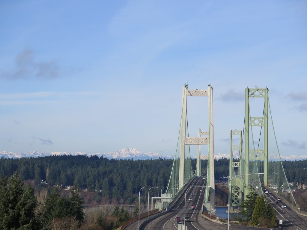
Follow the ramp up onto and over the bridge. There are good railings and the trail is completely separated from any vehicular traffic by a large concrete wall/barrier so there are no safety issues. One word of caution--it is quite high so take pity on folks in your party that might have a bit of acrophobia. Once across the bridge the trail ends in about a quarter mile at 24th St NW.

There is no easy parking on this end. Turn around and retrace your steps back across the bridge and up through the War Memorial. Round trip distance for this section is just 4.6 miles.

The views off the bridge are spectacular. Looking north provides close up views of the old original Narrows Bridge with Point Defiance and Vashon Island beyond. Views south down the Narrows channel include Fox Island, Ketron Island and Anderson Island past Steilacoom and Dupont all the way to the Nisqually National Wildlife Refuge, another great walk.

While this is still a relatively urban area with traffic noise there is quite a bit of wildlife - hawks, eagles, raven, etc - that nest in the crags on the west side of the channel plus seals, sea lions and if you are lucky, an occasional whale or porpoise in the water below.

Hike Description Written by
Erik Morgenstern, WTA Correspondent

Scott Pierson Trail

Map & Directions

Trailhead
Co-ordinates: 47.2580, -122.5371 Open in Google Maps

Before You Go

See weather forecast

Parking Pass/Entry Fee

None

WTA Pro Tip: Save a copy of our directions before you leave! App-based driving directions aren't always accurate and data connections may be unreliable as you drive to the trailhead.

Getting There

Driving Directions

The trail has access points all along its length but for the purpose of Narrows Bridge access, parking at Tacoma War Memorial Park is a very good option. To get to the park, take the N Jackson Ave exit from either direction Highway 16.

Head south on N Jackson Ave for one block, turn left (east) onto 6th Ave and the combined War Memorial/Narrows Park & Ride lot will be on your left (north) in about 300 yards right after the fire station.

Take Transit

Route 100 will get you closest to the trailhead, with a 3 minute walk from the nearest bus stop. Route 16 and Route 1 also get you within twenty minutes walking distance.

More Hike Details

Trailhead

Puget Sound and Islands > Seattle-Tacoma Area

City of Tacoma

You can improve or add to this guidebook entry!

Scott Pierson Trail

7 Trip Reports

Hiked here recently?

Submit a trip report!
 
Trip Reports